Grafton and Kidder Hill
Pair the green, inn, and Main Street maples with Kidder Hill Bridge in Grafton. This is the compact choice when foliage matters more than collecting several distant bridges.

Foliage and bridges
Start among Grafton's maples and white clapboard buildings, then choose a Grafton stop, the two Rockingham bridges, or a separate West Dummerston extension.
Pair the green, inn, and Main Street maples with Kidder Hill Bridge in Grafton. This is the compact choice when foliage matters more than collecting several distant bridges.
Bartonsville crosses the Williams River north of Saxtons River; Hall Bridge lies farther southeast on the Bellows Falls side of Rockingham. Both can fit a Rockingham half day.
Southern Vermont color often develops from late September into mid-October, with exact timing shaped by elevation, rain, and wind. Current foliage reports and recent local photographs are more useful than a fixed annual date.

For a short outing, keep the village and Kidder Hill together. Allow a half day for the Rockingham pair: Bartonsville belongs on the Chester side, while Hall Bridge fits a Route 121 drive through Saxtons River toward Bellows Falls. West Dummerston is south near Brattleboro and requires a separate half-day drive.
The four stops show different parts of Windham County: Grafton's wooded village edge, the Williams River at Bartonsville, the Bellows Falls side of Rockingham, and the broad southern valley at West Dummerston. Choose one cluster instead of putting all four on the same drive.
Bridge access, vehicle rules, and legal stopping space can change. Check New England 511 and the Vermont Covered Bridge Society, then omit any stop without a safe pull-off.
Covered bridge notes
Kidder Hill keeps the bridge search in Grafton. Bartonsville and Hall cover the Williams River and Rockingham side of the trip. West Dummerston changes the day into a southern Windham County drive rather than a Grafton loop.
Use Kidder Hill Bridge for a Grafton-only outing with the village green and Main Street. The creamery or trails can fill the rest of the same half day.
Bartonsville Bridge crosses the Williams River in northern Rockingham. Reach it on the Route 103 side near Chester before continuing toward Saxtons River.
Hall Bridge is on the Bellows Falls side of Rockingham. Reach it from the lower Route 121 corridor through Saxtons River on the longer Rockingham route.
West Dummerston Bridge is near Brattleboro in the West River valley. It is the southern extension, not another stop on the Rockingham pair from Grafton.
Photograph the green and Main Street first, then choose one bridge cluster. The Grafton option leaves time for the creamery or trails. The Rockingham pair fills the middle of the day and returns through Saxtons River. West Dummerston replaces those stops with a longer drive toward the West River valley.
Use the current bridge directory for identity and New England 511 for road conditions. Neither source guarantees a legal roadside pull-off, so skip a stop when parking is unclear.
Second Star gear guide
Mountain Town Day Kit
Mountain-town packing list
Light trail shoes, water, rain backup, a fleece, sunscreen, binoculars, and car pieces for town-to-trail mountain weekends.
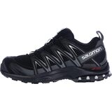
Trail Running Shoes
$150.00
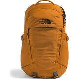
Daypacks & Packs
$86.93
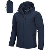
Packable Rain Jackets
$56.99